The Internet is supposed to be a place to find information, isn't it? With that in mind, I will do a travel log to the places we go and to a few places we have been. I usually do quite a bit of internet research (I say that tongue in cheek, I guess) on the places we go before we actually go there. So, for the readers of this blog, or for people who come across this blog through internet searches for the destination of topic I will provide all the information I can on the subjects at hand. The only thing I request is that you leave a comment in the comment section telling us you used this information.
Swasey Lakes: Getting to The Trail head
The path recommended to us to get to the Swasey Hole area was through the Center Park Trail head north of Duchesne. We took I-80 from Salt Lake and turned off on Highway 40 at Park City. That took us right into Duchesne. Gas in Duchesne was petty costly, so I would recommend filling up somewhere before, or at the latest Heber City. From Duchesne we turned left off of their main street onto Highway 87 and drove to Mountain Home. From Mountain Home, you get off onto dirt roads. You follow Yellowstone River Road 4 miles to Hells Canyon Road. The trail head is 7 miles up that road. The roads are decent and you pass quite a few good places to camp if you want to camp overnight before starting the hike. We were pleasantly surprised to see the roads so well marked. We didn't get to Mountain Home until it was dark and we still found it to a good camping spot near the trail head with relative ease.
There is a Snotel Station near the trail head (Click Here) Snotel Stations are a good way to get a gauge on the weather in the area and also if you will encounter any snow.
For more info on the path to the Center Park Trail head, click Here (scroll down to the center park trail head section), and Here.
Having the USGS map and/or the Nat Geo. (#711 I believe) map of the area does help you get to the trail head as well as once you get on the trail.
Here are directions from Google Earth (it estimates the trip to be 133 miles from Salt Lake City):
Swasey Lakes: The Hike
The hike in was pretty tough for a bunch of guys who had not attempted any such thing for at least ten years. I personally believe that the altitude difference also had a previously not factored effect on us. We all live at around 4,000 feet above sea level. Our hike began at around 10,700 feet above sea level. To say that we were exhausted when we arrived at our destination is almost an understatement.
The trail in, however, was in pretty good shape. We lost the trail once, only momentarily, around the wilderness boundary. There were plenty of boulders in a few areas. We encountered some people who had hiked in on horseback and said the ride to Swasey Hole was about two hours for them. As we hiked, however, we kept wondering how horses could go on some of the terrain. Please be aware that there is no marked trail going into the Swasey Hole area. It seems like most people turn after the main stream at the bottom of the valley just as you start to climb uphill again. I would recommend this route. Going out, it is relatively easy to follow the trail from the lakes, but unless you knew where it was going in, it could be hard to find. Going in we went almost to the base of the ridge, then turned left and went through the rock fields until we came to the lakes. Going over the boulders was a little difficult with a heavy pack on, and as I said previously, I would take the option just after the creek if I were to do it again.
Some sites I looked at estimated the trip to be around 6 miles. We estimate that we added about an extra mile to our trip by going to the base of the ridge. The hike in took us more than six hours (which we attribute to our not taking the stream in... and our exhaustion) and going out it took us about three-and-a-half hours.
Here is a GPS map and an elevation profile from this website from this website (This site also has some excellent photos of the area:
 Here are some photos and Google EarthThe trail in with a rough (and I do mean rough) sketch of where the trail takes you.
Here is Swasey Hole. We found a good camp spot on the north corner of the big lake in a small grassy area in the rocks. Most of the other camp sites we came upon in our exploration of the lake were riddled with rocks and a lack of flat space. Our camp site was good for us in that it was nice and flat and open.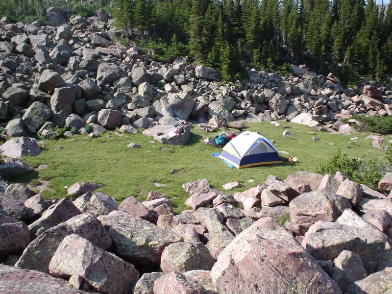
Our campsite.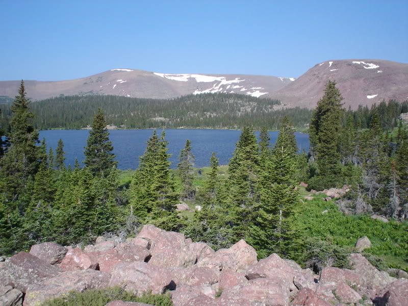
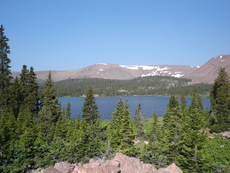
View of the lake from near our campsite.
Here is a view of the trail and geography above Swasey Hole and the Swasey Lakes. There are plenty of lakes up the trail a bit (about 4 miles, I believe). We did not make it there, but I have heard good things about the area and that it would make a good day hike for fishing.
The hike out was much easier than the hike in. I believe this was due to our following the main stream out of the Swasey Hole area. Also, you reach the base of the mountain on the way out and know that once you climb that it's all pretty much all downhill from there.
Swasey Lakes: Fishing
We did plenty of fishing while we were there. We had some good success on both the big lake and the smaller lake next to the big lake. I packed both a standard fishing rod and a fly fishing rod in with me. I actually broke the tip off of my fly rod on a tree going in, so I used it sparingly. Another in our party, however, used his fly rod and had good success one evening. The fish were rising in the mornings and evening and if you had the right fly, they took it (small, mosquito-type flies seemed to work the best). Spinner fishing also worked well. We even pulled out a couple of 12-14 inch fish out of the smaller lake. We used a combination of different spinners, but the classic panther martin and similar type lures seemed to work the best. The fish selection consisted of cutthroat and brook trout (apparently some sites say that there are some rainbow trout in there as well).
Also, I am not a big fish eater, but the trout we caught was very good to eat. Each night we were there we cooked up some fish in tinfoil with butter and lemon pepper. It was excellent! While we were there the cutthroat trout were spawning in one of the nearby creeks. That was interesting to see. They were packed into the little stream as tight as could be and appeared to be very, very on edge.
Swasey Lakes: Final Notes
We heard about the Swasey Hole area from a friend who is a forest ranger in the area. For a moderate hike in the trip was about as good as could be hoped for. The one wish our group had was that we had been a bit better physical shape before we went so we could have felt like we could explore the surrounding area a bit more.
If you need to stop for groceries or anything similar before you get there, I would recommend doing so before Duchesne. Heber City would probably be the last place to find a Wal-Mart-type store. You can get gas in Duchesne and there are also a few restaurants. Like many small towns, however, everything seems to close pretty early in the evening- so better safe than sorry, in my opinion. Gas was also much more expensive there. It was, however readily available regardless of what time it was.
One person in our group brought a Spot Personal Satellite Messenger (available here, or at the official website). The Spot is a device that sends an e-mail or text message to a pre-determined list of people telling them that you are okay or are in trouble and need help. All in our group had families. The Spot was a good way to calm the fears of our wives that something was going to happen to us while we were alone in the wilderness. We sent messages to our families three times a day and they got all of them.
Finally, for more info. on this area, click here, or here.
For coordinates to the area, click here.
Here are some additional photos: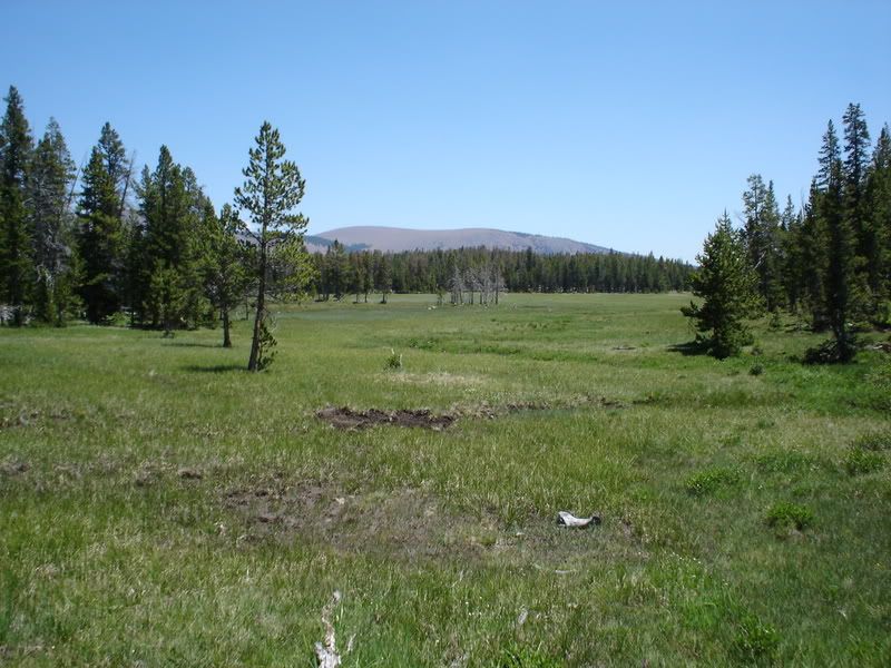
This is a meadow near the trail head.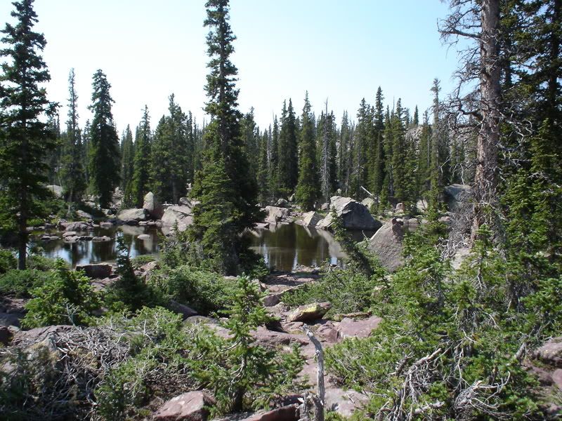
This is a rock field and pond near the wilderness boundary.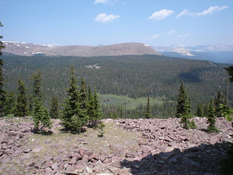
View from near the trail summit. You can see the ridge off in the distance. Swasey Hole is at the base of that ridge.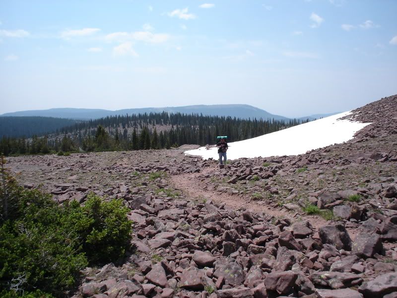
Snow in July near the trail summit.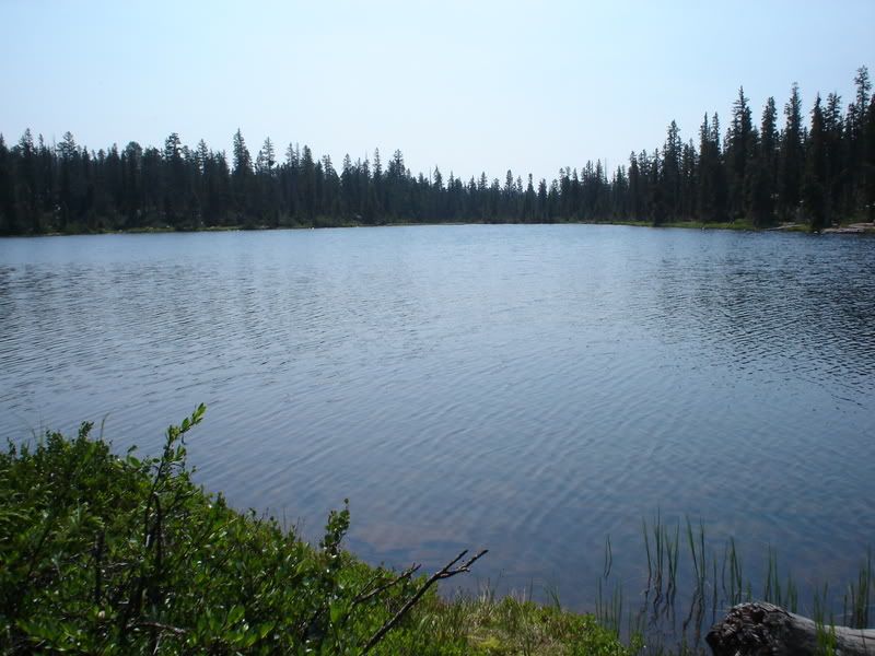
The smaller lake.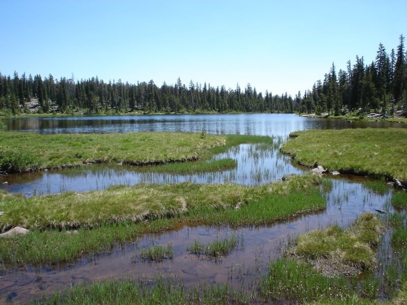
The stream going out of the smaller lake. This is the stream that you basically follow in from the trail.
Thursday, July 24, 2008
Travel log: Swasey Lakes in the Uinta Mountains of Utah
Posted by faithanddustin at 7:50 AM
Subscribe to:
Post Comments (Atom)
2 comments:
Holy Cow! I would not have recognized Cody. Crazy! Sounds like fun! I haven't had a good camping hike in a while! Maybe I should go on a mancation! He he J/K. Good to see things are going good for you!
Planning a trip this summer with my three sons. Thanks for the info I haven't been there in almost 30 years and can't wait to go back.
Post a Comment